Wednesday, September 7, 2016

GDT Day 35 - Chama to Echo Ampitheater CG

Mon Sept. 5, 2016

Start - ~7871'
High pt  7871'
Lo pt 6600'
End Elv ~6600'
Climbing 1800' according to Google Maps

Miles ~43
Total time 5:00
Ride time 4:15
Day with BOB 33

Day 2 of my paved detour. I work up early to rain, again.... I have an easy day, so I roll over and go back to sleep. Besides, I checked my food into the office since I can't hang it here to prevent animal predation on my maple oatmeal and PB, and they don't open until 9 am.
I have a bagel and coffee while finishing packing, and watching the clouds and clearings in the sky, wondering which shall win the day.

l pack up a wet tent (again), and start the ride. It is mostly grey with an irritating head wind, but the temperature is pleasant and riding is okay on a wide shoulder as I exit Chama. On pavement with net downhill, the miles add up quickly.
 After I ride several miles, it is clear the blue sky shall win the day in the Rio Chama Valley, but clouds will rule for a while yet in the mountains to east that hold the official off pavement route. I have made the right choice. I cruise down valley, and then start cutting over ridges and in and out of drainages, always a bit lower on the south side. The mountains become more mesa like, and the trees change from ponderosa to pinon, juniper and scrub oak. I can see evidence of summer is starting to loosing it grasp, as a few oaks are starting to fade and change color. The aspens showed a bit of this yesterday up higher, but only one branch yet on but a scattered few trees.

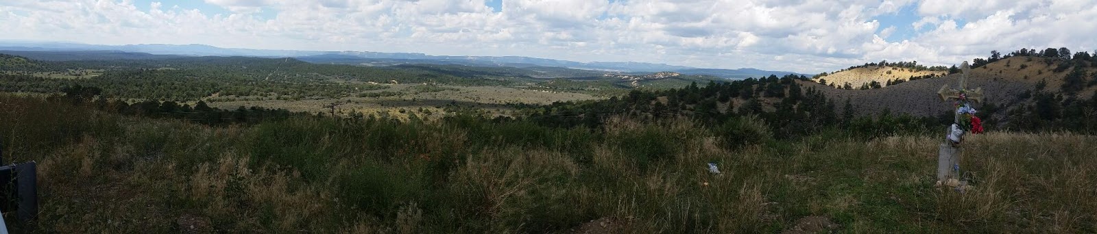
I reach the last long climb over a ridge and begin the long downhill toward the campground. The landforms are changing, rincons and cliffs manifest as guides to the highway. I stop at a little local roadside shrine to the Virgin Maria. A poingent space, and a manifestation of the old and deeply held culture in these lands.

As I am coasting down the 8 miles descent to the campground, I notice a new and unhappy noise eminating from my bike. It is the cadence of the turning tire. I stop several times to investigate. I think it is from my rear but will wait until camp to investigate. In camp, I diagnose it as my free wheel, but am not sure. If so, this is not field repairable, and I am heading into bike shop no mans land. Fortunately, tomorrow I am meeting Glenda for a few days, and it looks like one of those will be a trip to a bike shop in Taos or Santa Fe, as a field failure could leave me stranded.
Sooo, maybe the rain gods were doing me a favor, keeping from being deep in the backcountry with this issues....

The cliffs at the Echo Ampitheater CG are gorge-ous and the Ampitheater it does indeed collect and redirect sound. The little hidden vale it is in is a wetter micro-climate as well, with larger trees providing shade and an intimate retreat from the openness of the drier, sparser lands just a short walk away.

GDT Day 34 - Elk Creek CG to Chama

Sat. Sept. 3, 2016

Start - ~9800'
High pt  10230'
Lo pt 7871'
End Elv ~7871'
Climbing 1900'

Miles ~25
Total time 5:00
Ride time
Day with BOB 32

Good morning, fog shine. I was hoping for a drying pattern would be taking over, given my InReach weather report. However, it rained again over night.  This is very crucial intel, as the roads can be bad or even impassble in places on the route over the next 3 days. First place that is impassible is only a couple of miles off pavement on todays route.

I ride up paved La Manga Pass, with 7% grades in places. I am getting closer and closer to New  Mexico. Indeed I have been in part of old Mexico, New Spain for quite a while now through southern Colorado. You will notice Spanish place names have been showing up. Salida, Del Norte, Carnero Pass, Pentitente Canyon, Rio Grande, Plataro, Horca. The Spanish settlement of these parts pre-date the inclusion in the USA. More than place names remain, their are old families whose roots go back many generations, more so in New Mexico but also here.

I get to my turn off, and the grey and dark clouds are manifest again. I have checked a couple of side roads along the way, some look pretty muddy. I decide to take the recommended paved wet weather detour to Abiquiu, it certainy has been a cold and wet pattern for a few weeks in these mountains. I dont want to get delayed as I am to meet Glenda in Abiquiu on Monday, as well as I would like to dry out and not ride in the rain and grit.
So I stay on the highway to Chama NM. I enter New Mexico, the land of enchantment. I am hoping for more enchanting weather here! One could argue I have finished another state when I exited Colorado. This does leave uncovered just a few miles of formal, backcountry route left in Colorado,as well as the mountainous northern NM. Which, BTW, I am very interested in exploring this 110 mile stretch through these New Mexico mountains. Some day.....

As I start up Cumbres Pass I see the Cumbres and Toltec narrow gage coalburning tourist train smoking and chugging it's way to Antinito via the Toltec Gorge. Cumbres Pass is also the pass for the rail line, and it has a depot and extensive operations history.
It is a 10 mile cruise down to Chama losing 2200'.  I stay at the friendly and shady Rio Chama RV park, right on the Rio Chama and the rail line. Close enough in town to get dinner and visit the local tap room, sample a couple of different NM micro brews. It is an art tour weekend, and the tap house is hosting a number of works. All and all, a pleasant visit to charming Chama.

Saturday, September 3, 2016

GDT Day 33 - Stunner CG to Elk Creek CG at Horca

Fri. Sept. 2, 2016

Start - ~9800'
High pt  10582'
Lo pt 8725'
End Elv ~8725'
Climbing 1000'

Miles 33.9
Total time 5:30
Ride time 3:45
Day with BOB 31

Short day today, and I use a bit more time before departing to try to let the intemittant sun try to dry out gear,  though not alot of success. Day starts with a 700 ft climb over Stunner Pass and a switchback downhill to Plataro.
I get some good views of the red mountains, with their colorful mineral rich ore exposed to sun and rain.
I stop at the lodge in Plataro and have a hot lunch for a change. That burger tasted good. They have a board where the divide racers sign in. They sometimes stay open late during the race to feed late arriving racers, as it is the first place to get food since Del Norte.
Then it is an easy 20+ mile cruise down the beautiful Conejos River vale, dodging dark clouds, and chasing sun patches.  Nice looking mountains are quilted with patches of aspen groves. I will be back in the fall sometime, and perhaps to fish.

I wander into Horca early, and the one retail restuarant/grocerye stablishment is shutdown, another in an unfortunate pattern along the route.
I take the back way to Elk Creek CG since it appears the route road is washed out. I score a campsite right next to the creek and the weather is sunnier down here, so
I start drying things out. With all of the rainy weather, I have been careful to segregate gear to always make sure I have dry change while biking, and dry socks, shoes, and clothes for camp. That said, I am cold much of the time in this rainy weather pattern, both ascending and descending. I am hoping for dry biking shoes and socks for the morrow, and it looks like Mother Nature will help this afternoon.

GDT Day 32 - Del Norte to Stunner CG

Thur. Sept. 1, 2016

Start - ~7874'
High pt  11910'
Lo pt 7874'
End Elv ~9800'
Climbing 4800'

Miles 44
Total time 9:00
Ride time 6:45
Day with BOB 30

This the BIG DAY; the most climbing in any given day to the high point of the route. I think this os the highest I have been on a MTB. The highest the BOB has been.

I got up early today and packed up. Mostly to partly cloudy, though the clouds retreat quite a bit with the growing reach of the sun. A good sign. No cooking as I grab a coffee and a yummy breakfast burrito at The Perks on my way out of town. It is about 24 miles from town to the summit of Indiana Pass. It is about half paved, half good gravel road, but most of the climbing is on dirt. I did have to ride in the ditch for a mile on the paved section due to fresh tar road work. Nice ranching valley followed the pavement, with the valley narrowing and getting quite a bit steeper as the pavement ends, and it stays climbing for 12 miles non stop after that point. I can see there are dead groves of conifers up higher. As I reach those lofty elevations, I can see that spruce genocide has occured, at least for a certain age tree.
I crest the pass, which is right at treeline at this latitude, having escaped the dark clouds that were building during my ascent. But breaching the pass, it is quite clear I will not escape their fury for long, as there is a large rainstorm occupying the basin further down. This does put some square top mountains in ever fading relief until they are drowned in grey, not too far distant I am afraid.
I change to dry and warmer clothes and rain gear and head on down. I get a mile or two before I need to hide under a friendly group of firs. I have lunch to bide the time and wait out the heaviest of the rain.
I restart and start peddling down toward Summitville, an old gold campsite and current superfubd site. This leg of the route it is advised to carry extra water since a long strech of the route is contaminated. Don't see much of the devastation other than the brightly covered creek as I a in the middle of 2.5 hours of steady rain, and my reality has narrowed to the road and the odometer mostly. There are a couple of modest climbs out of the Summitville basin, and I  am actually glad for them, as they help keep me warm and hypothermia at bay. I soon reach the top of the climb, close to the continental dividen near Elwood Pass, and the long downhill to Stunner begins, and so does a growing chill. The bike is showing the aftermath of a long wet ride, everything has mud or grit on it.

Setting up camp in the empty campground helps get the blood flowing good again. Despite reports of a pump, I  can't find it and it looks to me it was removed. The local portion of the Alamosa river is contaminated as well, in part due to natural breaching of heavy metal ore, and also some mining. Good thing I hauled the extra water, as I have just enough to make dinnet anf breakfast work.
Partially cloudy as I prep dinner and go to bed, but I detect 4 or 5 rain showers over night. The next morning, the sun breaks through as oft as not, helping warm my body and spirits. Cool clouds are born in the forested ridges and set free into the morning light to drift to their destiny (likely to rain on me layer 😉)

Wednesday, August 31, 2016

GDT Day 31 - Pentitente to Del Norte


Mon. Aug. 29, 2016

Start - ~ 7950'
High pt  8500'
Lo pt  7884
End Elv ~7884
Climbing 800'?

Miles 20.2
Total time 3:30
Ride time 2:23
Day with BOB 29

Wet night, wet morning, but sun is out to help dry things out. I had water in the tent after the long rains of last night, and wanted to use the sun to dry out, while I had it. This led to my latest departure of the trip to date, at 10:30

Ominous  clouds over the mountians to the SSW of Del Norte, my next route ride. Also to the west of me over the divide.
The riding was slow due to the roads being soft from the rains, but not muddy. I feel tired today, even though riding and climbing is not much. I do get off groomed county rpads on to much more primitive forest roads, (funny name for a 2 track without trees). This is my 9th day of riding in a row, and I think I will take a day off in Del Norte to rest, shower, do laundry, and re provision for the 5 day trip to Abiquiu. I will also check the weather, hoping Neales report of high pressure building by mid week holds. I really don't want to take the routes biggest climb to its high point of 11,900' with rainy thunderstorms as accompaniment.

The ride today goes through more volcanic rim rock and outcroppings surrounded by barren lands. I had hoped to ride a couple mile detour to La Ventana, an arch in a volcanic dike. But given the state of the clouds, and feeling tired, I want to push on before storms and wetness returns.