Colorado Trail - Day 5 Georgia ridge to Breckenridge
Segment - part of 6
Thurs Aug 30th, 2018
Start 11031
High pt 11850'
Lo pt. 9500
End Elv. 9600
Climbing ~1600?
Miles 24 ish
Total time 5:30
Ride time 3:40???
Slept in and had a leisurely break fast and break camp. No rush today, as it will be mostly downhill into Summit County after summiting Georgia Pass, and I want to enjoy and appreciate the alpine environment.
Dave the hiker is long gone when I push my bike to the trail from my campsite below.
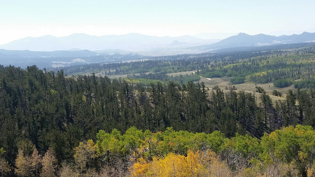
The riding is technically easier than the previous 3 miles of climbing and not quite as steep, but rarified air pushing to nearly 12000 feet compensates for it. I soon start breaking out of the trees and approaching tree line proper. The air is clear today, and the views humbling in their gorgousness. South Park slowly is revealed as it stretches out below me, while each turn if the crank brings Summit County's Ten Mile range closer.
I meet a CT thru hike heading to Denver, all smiles now that the last continental divide crossing is behind her.
I reach the high point, and I dwell and soak it all in.
The route goes well above the pass proper, and I think of the handful of times I have been at the pass in the past. The first was to summit Mt. Guyot with Steve and Glenda, the 2nd was a mountain bike explore from the Summit County side, and the most recent was a shake down trip with the trailer in prep for the GDR phase 1 2 years ago. Of those, I have never take the CT from the pass, so new trails forward!
I have a net 2200' of decent awaiting me. It starts off mild and flowy above tree line for a few miles and the descent starts in eanest. The trail transitons to much more techical as the rocky mountains earn their moniker. The Steed is handling it well, in fact may be more stable do to the lower load on the back. After a final tortuous mile of rock gardens, I cross the first branch of the Swan. Up and over a ridge I get to the middle fork of the Swan and meet up with Dave the hiker. I exit the CT as the next section is a long steep climb up west ridge, which I have done before. Riding down the road along Swan River and meet the CT again after exploring Muggins Gulch.
Yippee kyYea - flowing and mostly smooth trail awaits right through to Horseshoe Gulch. A small climb on the last section that leads a good downhill and the final super tight switch backs to Hwy 9. Finally, the bike path to the Broken Compass brewery to celebrate my completion the front range traverse.
This was 150 miles, about 50% single track, some quite challenging. It was a good test of the replacement bolts for rear rack, which I had sheared 2 factory bolts a couple weeks earlier on the divide.
All and all, pleased with results, and I will do more, but maybe not all segments will be with a loaded bikepacking rig.


