Sunday, September 11, 2016

GDT Day 37 - Part way up Cumbres Pass to Cisneros Park

Fri. Sept. 9, 2016

Start - ~9975'
High pt  ~10950'
Lo pt 8850'
End Elv ~9330'
Climbing 2000+'?

Miles ~44.2
Total time 7:30
Ride time ???
Day with BOB 35

Beautiful blue bird day, got out of camp early and had a spicy breakfast burro at Fina Diner in Chama.
 Glenda dropped me off on CO Hwy 17 where I would have left the pavement during the rainy patch earlier. It is mostly dried out now, but there are still some big mud holes to negotiate around. The forest roads as much more primitive and rougher than those I have experienced so far. I made the right call last Saturday to stay on the pavement.
What a nice day to ride; it is warm, sunny, just a bit of a breeze, and remarkably nice mountain country to boot.

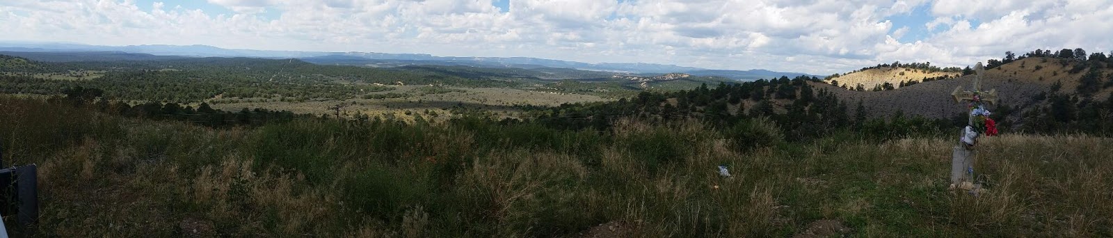
I did have my first hike a bike since Montana,  a half mile stretch of steep and very rocky terrain to gain the Brazos Ridge. It was worth it for the fantastic views into the Las Cruces Basin, and the Sangres off in the distance.  The route rolled through sparse trees and denser groves, with vistas of mellow rolling mountains near by complemented by more distant views at many junctures.

I have now finished the off pavement route in Colorado. I begin about a 2+ week solo section, with some challenging climbs and mountains, and challenges with water and supplies. I start in moutains, hit arid canyons and plains, and then to the steep riding of the Gila mountains before the chihuahua desert and the border. There are no bike shops until Silver City, in the south side of the Gila Mountains. BTW, the griding noise coming from my rear hub went away with a thorough cleaning during my stay at the Abiquiu Reservoir. I am hoping it was only dirt and grit from all of the wet riding. Fingers crossed.

Thursday, September 8, 2016

Abiquiu Exploring

Spent a few days exploring the Abiquiu area with Glenda. There are many convergences here. Native American, Spanish and Anglo influences are all here. Zen Garden, peace circle, contemplative monastary, spirit labyrinth, mosque, moradas, road side shrines to the lady of Guadalupe, yoga, weaving schools, healing waters spa all coexist in this geographic area. With all of this drifting on the winds, I was tempted to float away on one or more of these spritual breezes  from my goal of completing the ride. However, while sipping lavender tinctured tea, under an ancient and timeless cottonwood tree  at the Adobe Lavender Farm, the incredible weather has gotten me antsy for getting back on the route. So Glenda suggests that I restart tomorrow, Friday. So that is the plan, she will drop me off north of Chama so I can hit those backroads over the northern New Mecican mountains on route that I missed a few days ago.

In the interim, we hit a number of  worthwhile sites. Ghost Ranch is tucked into those fantastic cliffs, with Mount Perendal prominent on the skyline. The Chama River valley is also very nice cliff country with the river ever carving it way down
This valley lead to the christ of the desert monastary, a quiet contemplative place, surrounded by wilderness showcasing the creators handiwork.
We soaked in the relaxing and healing waters of Ojo Caliente (good call Neale). Had some fantastic New Mexican food in the little village of El Rito, at El Farolito anchored by its excellent green chile. ( another good call Jim)
We saw some very nice sunsets right from our campsite, a free show for just showing up.
All and all, a very nice few days together exploring.

Wednesday, September 7, 2016

GDT Day 36 - Echo Ampitheater CG to Abiquiu Reservoir

 Sept. 5, 2016 labor day

Start - ~6600'
High pt  6600'
Lo pt 6300'
End Elv ~6300'
Climbing 750' according to Google Maps

Miles ~12
Total time 2:00?
Ride time
Day with BOB 34

A sunny dry morning!!! I am in the desert here. Fantastic cliffs and the amphitheater are brilliantly lit by the morning sun. I take my cooking gear and food, and ride to the picnic grounds in the amphitheater to soak up the glow while the tea kicks in and the oatmeal slowly becomes edible.
I am in no rush this morning as I have only about 12 miles to go to the reservoir and Glenda won't be there until 1 or 2. I don't want to dally too late however, as it is Labor Day, and the traffic heading back to Santa Fe and Albuquerque is along the same lanes as I and it will undoubtedly get heavier later in the day.

The fantastic cliffs on the west side slowy are swallowed back into the earths grasp, but those on east side are growing in height and color and more than compensate as I ride down the valley.
I soon pass Ghost Ranch, whose environs  have inspired many an artists' handiwork, starting with Georgia O'Keeffe, whose work and presence are singular in this valley.

Unfortunately, I lose the paved shoulder about here, and begin traversing several deep arroyos and canyons along the highway. It is not even noon yet, and I am being sucked along by so many RVs, towed boats, and giant SUVs I lose count,  and not a few supportive honks. This is nerve wracking wrestling the BOB up some of the climbs at just a few miles per hour, stuggling to stay on the white line with stream of large vehicles passing close by at times. Most are considerate and give extra berth when able, but there too many times when that is not possible and I can barely read the super large names of RVs whizzing past as I can no longer focus that close at my advanced age.

I turnoff of US 84 into the reservoir just before noon, and climb to the campground. It is actually hot here and I have to hide in the shade. What a change from a couple of days ago. The views from the campground are superb, with the promise of enchanting NM sunsets palpable.

GDT Day 35 - Chama to Echo Ampitheater CG

Mon Sept. 5, 2016

Start - ~7871'
High pt  7871'
Lo pt 6600'
End Elv ~6600'
Climbing 1800' according to Google Maps

Miles ~43
Total time 5:00
Ride time 4:15
Day with BOB 33

Day 2 of my paved detour. I work up early to rain, again.... I have an easy day, so I roll over and go back to sleep. Besides, I checked my food into the office since I can't hang it here to prevent animal predation on my maple oatmeal and PB, and they don't open until 9 am.
I have a bagel and coffee while finishing packing, and watching the clouds and clearings in the sky, wondering which shall win the day.

l pack up a wet tent (again), and start the ride. It is mostly grey with an irritating head wind, but the temperature is pleasant and riding is okay on a wide shoulder as I exit Chama. On pavement with net downhill, the miles add up quickly.
 After I ride several miles, it is clear the blue sky shall win the day in the Rio Chama Valley, but clouds will rule for a while yet in the mountains to east that hold the official off pavement route. I have made the right choice. I cruise down valley, and then start cutting over ridges and in and out of drainages, always a bit lower on the south side. The mountains become more mesa like, and the trees change from ponderosa to pinon, juniper and scrub oak. I can see evidence of summer is starting to loosing it grasp, as a few oaks are starting to fade and change color. The aspens showed a bit of this yesterday up higher, but only one branch yet on but a scattered few trees.

I reach the last long climb over a ridge and begin the long downhill toward the campground. The landforms are changing, rincons and cliffs manifest as guides to the highway. I stop at a little local roadside shrine to the Virgin Maria. A poingent space, and a manifestation of the old and deeply held culture in these lands.

As I am coasting down the 8 miles descent to the campground, I notice a new and unhappy noise eminating from my bike. It is the cadence of the turning tire. I stop several times to investigate. I think it is from my rear but will wait until camp to investigate. In camp, I diagnose it as my free wheel, but am not sure. If so, this is not field repairable, and I am heading into bike shop no mans land. Fortunately, tomorrow I am meeting Glenda for a few days, and it looks like one of those will be a trip to a bike shop in Taos or Santa Fe, as a field failure could leave me stranded.
Sooo, maybe the rain gods were doing me a favor, keeping from being deep in the backcountry with this issues....

The cliffs at the Echo Ampitheater CG are gorge-ous and the Ampitheater it does indeed collect and redirect sound. The little hidden vale it is in is a wetter micro-climate as well, with larger trees providing shade and an intimate retreat from the openness of the drier, sparser lands just a short walk away.

GDT Day 34 - Elk Creek CG to Chama

Sat. Sept. 3, 2016

Start - ~9800'
High pt  10230'
Lo pt 7871'
End Elv ~7871'
Climbing 1900'

Miles ~25
Total time 5:00
Ride time
Day with BOB 32

Good morning, fog shine. I was hoping for a drying pattern would be taking over, given my InReach weather report. However, it rained again over night.  This is very crucial intel, as the roads can be bad or even impassble in places on the route over the next 3 days. First place that is impassible is only a couple of miles off pavement on todays route.

I ride up paved La Manga Pass, with 7% grades in places. I am getting closer and closer to New  Mexico. Indeed I have been in part of old Mexico, New Spain for quite a while now through southern Colorado. You will notice Spanish place names have been showing up. Salida, Del Norte, Carnero Pass, Pentitente Canyon, Rio Grande, Plataro, Horca. The Spanish settlement of these parts pre-date the inclusion in the USA. More than place names remain, their are old families whose roots go back many generations, more so in New Mexico but also here.

I get to my turn off, and the grey and dark clouds are manifest again. I have checked a couple of side roads along the way, some look pretty muddy. I decide to take the recommended paved wet weather detour to Abiquiu, it certainy has been a cold and wet pattern for a few weeks in these mountains. I dont want to get delayed as I am to meet Glenda in Abiquiu on Monday, as well as I would like to dry out and not ride in the rain and grit.
So I stay on the highway to Chama NM. I enter New Mexico, the land of enchantment. I am hoping for more enchanting weather here! One could argue I have finished another state when I exited Colorado. This does leave uncovered just a few miles of formal, backcountry route left in Colorado,as well as the mountainous northern NM. Which, BTW, I am very interested in exploring this 110 mile stretch through these New Mexico mountains. Some day.....

As I start up Cumbres Pass I see the Cumbres and Toltec narrow gage coalburning tourist train smoking and chugging it's way to Antinito via the Toltec Gorge. Cumbres Pass is also the pass for the rail line, and it has a depot and extensive operations history.
It is a 10 mile cruise down to Chama losing 2200'.  I stay at the friendly and shady Rio Chama RV park, right on the Rio Chama and the rail line. Close enough in town to get dinner and visit the local tap room, sample a couple of different NM micro brews. It is an art tour weekend, and the tap house is hosting a number of works. All and all, a pleasant visit to charming Chama.