Thursday, August 9, 2018

GDR2 Day  6 Wayfarers to Cedar Creek CG

GDR2 Day  6 Wayfarers to Cedar Creek CG
Tues, Aug 7, 2018

Start. 2904 '
High pt  4800'
Lo pt.     2904
End Elv.  3320
Climbing 3000'?

Miles 38
Total time ~ 5:30
Ride time 4:31

Got started a bit earlier today (8:30 if curious) has the heatwave has restarted after the weekend.
After climbing through Bigfork, and riding down the middle of main street, I gain the old road bed trail along the Swan River. Delightful pedaling for 2 miles through the woods with the river as my guide, smiled on by the soft morning sun.
I gain the state hwy for but a mile to Ferndale and am then heading south toward the Mission Mountains. I soon see a few,turkeys ahead on the road. They exit stage right, while more wnter from stage left, quickly following the others. I see ten of them making rheir way across a pasture as o ride on. The road is paved for few miles, but as I go along the road base deteriates as the forest gets more wild and primeval looking. The pavement ends and the climbing begins in earnest. I am well above the Swan and soon get occasional peaks of Swan Lake far below through shrouded openings in the forest. The road is quite good, and eventually I see the sole auto for the day on the backcountry section. I do meet one other bike on a morning ride and a couple of motercycles doing the Divide, but I am enjoying the solitude of this area.
It is an over an hour of cranking up the 6 miles to the high point, which is an unmarked event. I then start a good long downhill to the Swan Wildlife Refuge, perhaps 6 or 8 miles and and then many more very pleasant modulating miles.
I control the speed on the downhill, in part to take it easier the the suspect rack, in part to enjoy the scenery along the way, but also due to this being bear country, and don't want to surprise any grizzled ursines. Lots of curves and short lines of site have me ringing my bell regularly. It really does look like bear country. I stop at many creeks and open/marsh areas looking to sight wildlife, but I only get to enjoy the landscapes.

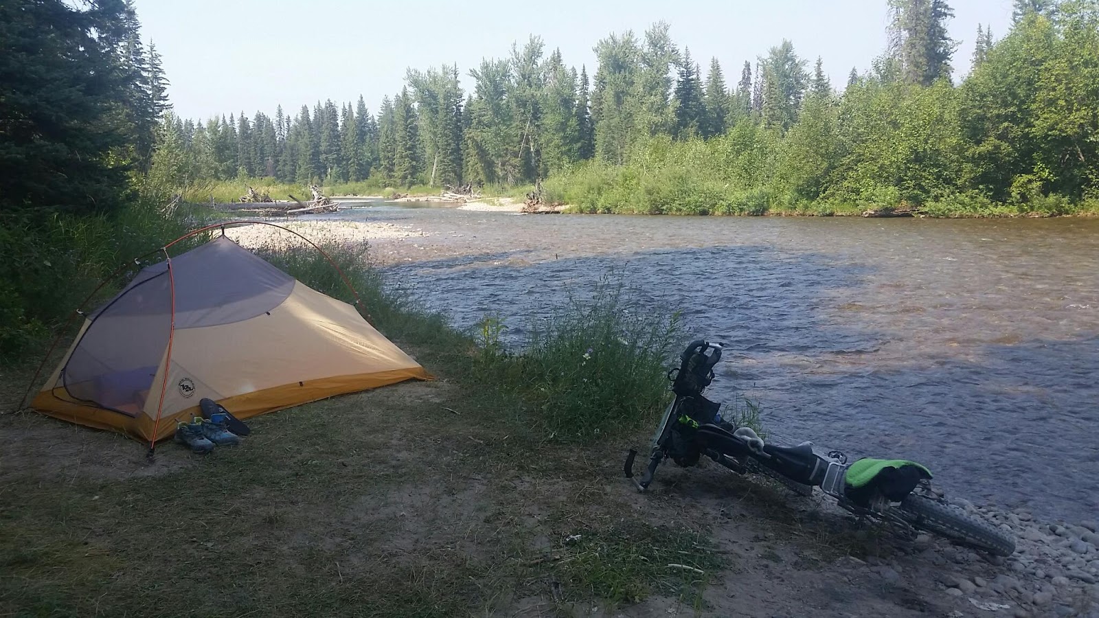
My map directions get a little confusing, but I locate the Cedar Creek CG 1 mile off route. Quite a primitive CG, but right on the Swan River, whose forever murmuring I will enjoy for my brief interlude there.

I did get to share a wonderful event as two families with young children started fording from the far side of the river, 3 adults and 2 kidd, maybe 4 and 6.
When they get back, the kids lay on the stone beach to warm up, and adults tend to gear and beer, which they share one with me. Whilst enjoying their generousity, one dad starts skipping rocks, and soon all are in, and search for the best skippers, and getting instruction from the dads.  Several make it across tbe 40 feet to the far shore. A pleasure to share these moments.

GDR2- Day5 Whitefish to Wayfarers State Park

GDR2- Day5 Whitefish to Wayfarers State Park
Sunday, Aug 5th, 2018

Start 3035'
High pt  3200'??
Lo pt.     2904
End Elv.  2904
Climbing ~600'??

Miles 48.8
Total time ~ 4:45
Ride time 4:09

Longest milage yet this time and it was easy forest and country lane pedaling with most roads paved and on a rectilinear layout. Scenery ranged from pastoral farm lands to very nice forests as the route tries to get close to the Swan Mountains, which dominates the eastern horizon all day. Lovely country really.
Met up with a rider from Switzerland, Gianni, we road together for maybe  20 miles chatting the whole way about our countries, life, the divide. Nice young guy.
Parted ways in Bigfork as I was off to Wayfarers to meet Glenda, and he was riding more miles.
Bigfork is a cute little town, a small compact example of a resort downtown, with a weekend art festival to boot. Bigfork is also home to the Flathead Brewery, an apparently very successful affair, which we did have to stop by and sample the wares.

Did decide to take an extra day at Bigfork and Wayfarers, to do some chores, shopping, and last ditch attempt on the elusive drain part (to no avail).
We did get to spend the afternoon paddle boarding in the Bigfork Bay and on Flathead Lake. That was fun to partake in one of the local water sport offerings, as this country is water sports crazy, with rafting, paddle boarding, swimming, kayaking, lake and fly fishing. May need to get one of those paddle board thingies, abd maybe a kayak, or two .....

GDR2 Day 4 - Upper Whitefish lake to Whitefish State Park

Sat, Aug 4
Start 4425'
High pt  4425'
Lo pt.     3035
End Elv.  3035
Climbing ~400'??

Miles 28.5
Total time ~ 3:30
Ride time 2:24

Downhill day! Yeah. Net loss in elevation.

Got a leisurely start today after a relaxing breakfast as it is a short ride for me and a reservation for Glenda at Whitefish State Park.
Started in wild forested area cruising down forest roads , with a patina of fine dust for the enjoyment of bicyclists as cars passed. Did see a fair number of riders heading north, 7 in 3 groups. Stopped and visited with one group of three. They were all wearing bandanas over their mouths and nose, like a posse of old in this far western locale.

Would run across empty cars parked along the side of the road, near no trails or side roads, which seemed curious. Then I noticed they were always in more open areas, old burns or logged areas. Must be hunting for hucks.

Did stop by a couple of friendly bike shops in Whitefish, to check them out, and to scout a bikepacking saddle bags.
Tough to fit on my small frame, so I am hoping the replacement rack bolt holds.
I have triaged the gear on the rack to reduce weight; not carrying 4 days of food, moved the tent to handlebar harness, let go of my tarp and some first aid items,  with a long goodbye. Hopefully won't need to use these.

Glenda did get a chance to do some stand-up paddle boarding today after we set up camp.
I did not SUP as I was hoping to find a solution for the busted sink drain in Kalispell before we moved on to more remote locales, but to no avail. It is standard abs plumbing, but has one unusual part that goes through the trailer wall, and that defeated the friendly RV tech to locate, or even find a part number. Bust out the wash basin for the duration!

Note on Whitefish state park; it is nice, and treed, with a boat ramp, beach on a cove, and showers!!! It is not a large property and does share a long property line with BNSF railroad, and we were visited regularly during our stay, about once per hour through the evening, night and morning.

Not the most restful place, but fortunately not a tough day tomorrow

Tuesday, August 7, 2018

Day 3 - Repairs

Turns out that Red Meadow Lake is essentially at the top of 6 miles of fun down hill to meet Glend at Upper Whitefish Lake. Much steeper heading down, picking my path but cruising at 15 to 20 mph. I start to hear an unusual sound from bike as I slow down over water bars. At first I think it just my back tire skidding. But alas, that theory is quickly debunked. Inspection reveal that one of the fine rack mounting bolts has sheared clean off. Bummer, big bummer actually, as removing a sheared bolt from a the bike frame brazeon would be tricky at home with all of my tools available. Could be a major challenge or even change for the trip. I am only 4 miles from Glenda, net down hill, so I decide to nurse it and limp back. After limping a bit, I decide to strap the loose point to the frame to limit the motion. I also remove the pannier and hang them from the handle bars to reduce weight on the rack. I toodle down the road the couple of miles, arriving not a little dejected. Thinking an expensive trip the local Whitefish bike shop is now on the agenda. Sigh....

I did pack replacements for the affected bolt, and inspection shows while sheared off flush on the outside, rack side of brazeon, there is some bolt extending beyond on the inside, enough for my handy-dandy needle nose vice grips I happen to carry on the bike. After some significant disassembly, I extract the remnant, and put it back together. Unfortunatle one of the lower struts is now bent and prevents the mounting bolt to go in true, and i essentially have to dissasseble the rack to do it right, and not wreck tbe braxeon.
While I did avail myself to my bike mechanics toolbox  allen wrenches, I am confident I could have done the repair in the backcountry. Not how intended to spend my stay at this lake, but i feel much better with sympathetic support from Glenda, (and a beer of course)

That said, my confidence it how robust the rack and panniers as been shattered. I am triaging gear to reduce weight on rack, in will probably take it easy on down hills. Re thinking a large bikepacking saddle bag to move some weight off the rack too. That might trigger replacing  my dropper post while touring...

I guess a trip to the bikeshop is in order after all. Whitefish is only 20 easy miles away.

Repair item #2.
Well, we have found a major leak in the camper drain plumbing. Staight enough to replace broken abs drain traps, but don't really have the tools. May need to look into this a bit when we get back to civilization (aka whitefish
/Kalispell )

Repair item #3
Adjustment really, the odometer is closer. Maybe only 1 to 1.5% off now, I should really tweak the settings a bit more, as the difference is causing me to 2nd guess my location more than I would like. No wrong or missed turns yets, and want to keep it that way, even at the end of a long day in the saddle (especially then)

Monday, August 6, 2018

GDR2 Day 3 - Tuchuck to Upper Whitefish Lake


Start - 4660'
High pt  5590' @ Red Meadow pass
Lo pt. -3970'
End Elv 4425'
Climbing ~2000+

Miles 36.96mm
Total time ~ 6:00
Ride time 4:30

Today started refeshingly chilly, after so many warm days in the Eureka area. We actaully had to get in to our sleeping bag last night!

The ride started with a good long down hill along Tuchuck, then Yakikak, and then quickly Trail creek. I am occasionally riding slow, in search of the delictable huckleberries, which I find but a few, though more of them are ripe. Meet another rider Dave, who on his return trip riding sort to north, this after riding north to south already this season, 4400 miles so far. He bubbles enthusiastically (he is going uphill, mind you). He is pumped up to share with me the location of a nearby massive spring in Trail creek, "best water in the country", and drinking it unfiltered. He is riding a Jones rig, which is very interesting too, with a very stable fork, and ability to reconfigure bottom bracket for touring or trails. Wishing him well, I continue down hill
 Massive fires in the park break the canopy and can see far down in the valley to trail creek. Doesn't look like much water.  A ways later, it is apparent that the creek is bone dry. It has been smoky up this way, and there are fire restrictions, but there was a lively medium sized creek above at our camp and others have joined it. Where did it go? Dave's springs no doubt. His coaching is good as I find the camp spot readily and walk down to the creek, which is now mummuring to me again, working it's enchantment on me as it did Dave. There are many springs bringing the creek to life in front of me, and more down stream. I filter my water at the springs outflow, to be safe, and indeed, it is the nectar that Dave foretold.
Not much further down, I spy Trail creek again, and it is quite large: the mystery of the disappearing creek is a mystery no more.
A few miles of flat forest pedaling brings me to North Fork Rd, which follows the north fork of the Flathead River, with Glacier NP beckoning just beyond. It is a somewhat busily and dustier ride here for 10 ish miles, though the Flathead shyly peaks through the the forest, while the soaring peaks of Glacier watch us both. Cabins are a regular fixture along the road, often with some adornment or decorations. But while I am working my way downhill, there is enough little climbs, dusty cars passing, and gravel surface to negotiate, I am welcome the turn up to Red Meadow pass and campground. This forest service road is actually very nice riding gradually climbing with a bike friendly grade for 10 of the 12 miles to the summit. The last couple of miles I am back to the marking my progress in tenths or 1/4 mile increments (really! I've only gone a tenth since I last checked!!!  Better hunker down more). I am welcomed by breezy Red Meadow Lake at the summit, and rest and seach the impossible steep mountain face for wildlife ( the whole mountain face appears to be avalanche chutes). I have seen evidence of bear on the road yesterday and today. Keep a clean camp and bear spray handy!

Turns out the lake is essentially at the top so 6 miles of fun down hill to meet Glend at Upper Whitefish lake. Much steeper heading down picking my path but cruising at 15 to 20 mph. I start to hear an unusual sound from bike as I slow down over water bars. At first I think it just my back tire skidding. But alas, that theory is quickly debunked. Inspection reveal that one of the fine rack mounting bolts has sheared clean off. Bummer, big bummer actually, but that is a tale for another post.
Limp down to the campground at upper Whitefish lake, where Glenda has a spot next to the outlet river. On a near by bridge is some hidden art, perhaps a memorial.