Colorado Trail - Day 4 Teepee campsite to Georgia ridge
Segment 5 bike portion and part of 6
Wed Aug 29th, 2018
Start 9800
High pt 11031
Lo pt. 9600
End Elv. 11031
Climbing ~3200?
Miles 22.7
Total time 7:40
Ride time 4:40???
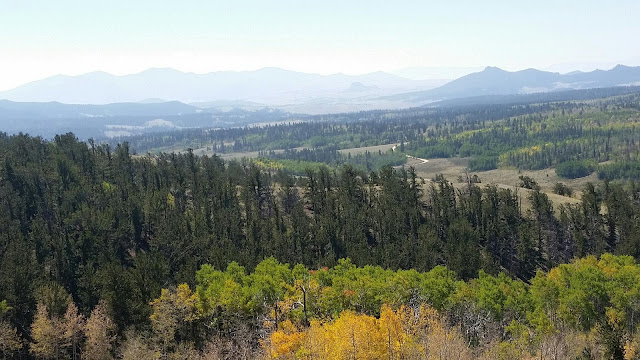
Got up to a cloudy morning, ate and broke camp. Started my day cruising down the road off of Rock Creek Ridge followed by a climb up to the Rock Creek trailhead, where I caught the CT once again. Then it was up the trail to Kenosha. Got some nice views into Lost Park, would be good to explore some time.
The leaves are turning early this year, I hear due to dry year we have had. While the aspen above are turning yellow, so be the fern undergrowth, its verdency fleeing along with long summer days, racing to autumn and winter beyond.
The riding is a mix of aspen groves, bristlecones, and open park land. The grasshoppers are abundant along the trail in the parkland and my approaching alights flocks in waves of flight
before me, my bike a prow in the ocean.
I reach Kenosha, score some water at the campground and await the arrival of lovely Glenda.
She arrives and we share lunch and company, restocking on food for the next 2 days to Breckenridge.
Then it the modest climb up from Kenosha and more great aspen groves, with pretty flowy and mostly smooth trail down to west Jefferson creek. I had contemplates camping here, at one of the FS campgrounds but is only 3 pm. It is 6 miles to Georgia pass, but the CT databook says there is water and camp sites about 3 miles in, so up up and away.
I cross the creek and meet a CT hiker Dave who is just starting to setup camp. We chat and he says he is setting up early as the next campsite and water are 6 miles away. I share with him my info from the d latest CT data book (camp sites and water at 6 AND 3 miles) and he decide to go further as well.
So up up up. The climbing starts immediately and is quite technical, with many a roots and rocks to navigate. It is mostly rideable, though there many, many occasions I have to push the bike around a rock or root when I pick a bad line, or cant get over. It is some hard riding these 3 miles, toughest bikepacking yet.
I also stop many many times just to catch my breathe, hydrate, and , yes, contemplate. But persistence prevails, and the grade relents a wee bit. I pass a mere trickle at close to the right odometer reading, I am hoping this is not the ."small stream with camping near by". No camping so I go on, but am eager to be done today too. Another wee trickle.of water, and there is cample 50 feet further. Well this has to be the camp spots, but is this the streem? I park my bike and hike on, fortunately a sizeable stream 30 yards further.
Setup camp in the spruce grove, do my nightly rituals, contemplating the push up to Georgia Pass in the morn.


No comments:
Post a Comment